
Veteran Precision.
Mississippi Roots.
Landis Prince delivers military-grade aerial application and 6K intelligence across Agriculture, Infrastructure, Golf, and Land Management.
Agriculture
Precision spraying and crop scouting to maximize yields with zero soil compaction.
Ag Solutions 🏗️Infrastructure
6K high-res utility, tower, and levee inspections to mitigate human risk.
Inspections ⛳Golf Courses
Thermal moisture mapping and surgical turf application without the footprint.
Course Intel 🦌Land Management
Thermal deer recovery, property mapping, and tactical predator surveillance.
Land Services
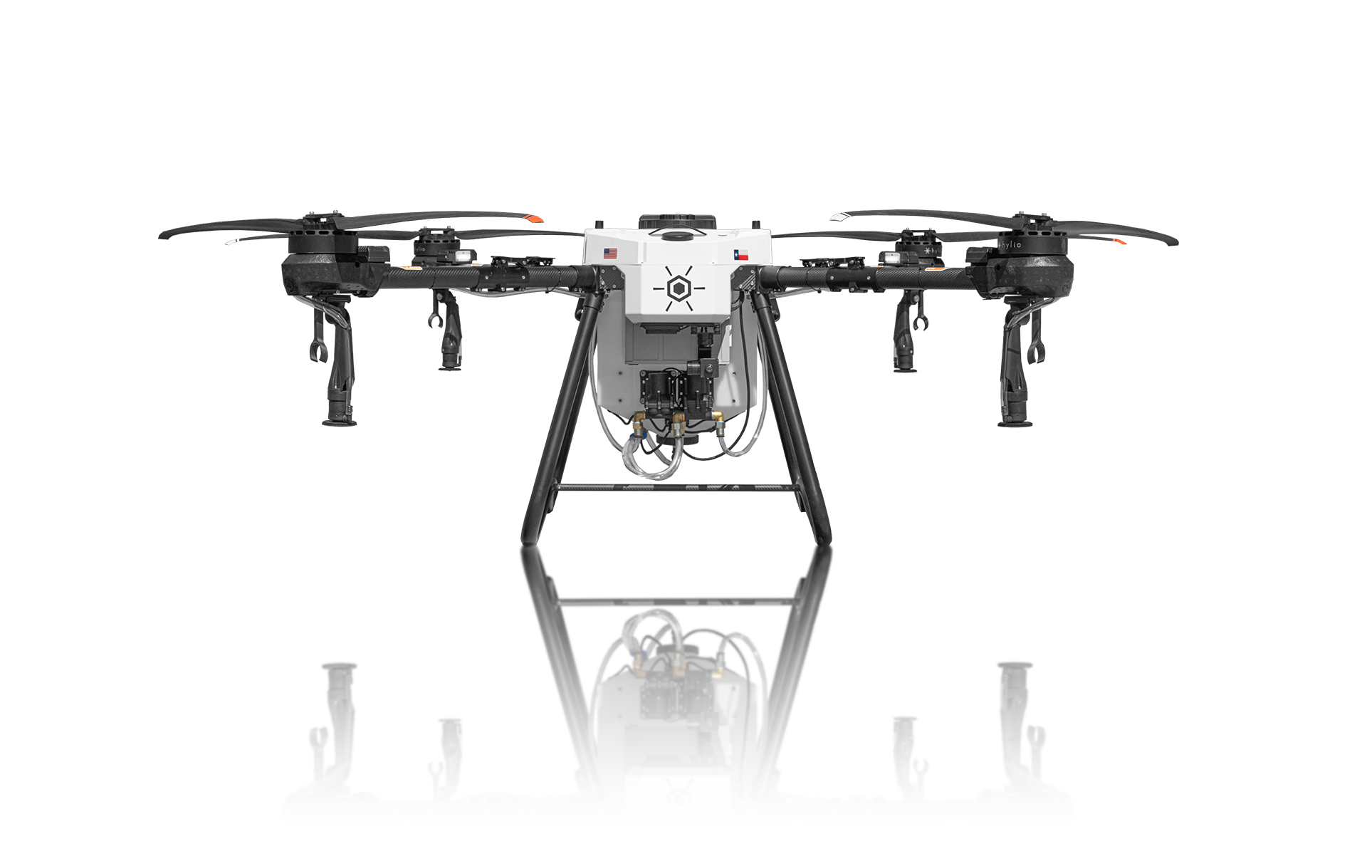
Ares — Hylio Agricultural Platform
Ares is Hylio’s purpose-built agricultural airframe for commercial missions. It pairs rugged, field-ready hardware with advanced mission controls so operators can spray, seed, and scout precisely and repeatedly across acreage.
- American-made and NDAA-compliant
- Swarm-capable for coordinated, large-scale work
- Engineered for precision variable-rate spraying
- Redundant safety systems, enterprise telemetry, and FPV/obstacle sensing
AgroSol GCS — Ground Link & Chemical Tracking
AgroSol GCS (Hylio’s ground-link control software) pairs with the Hylio GroundLink controller and Smart Tank telemetry to give real-time metering, low-error chemical usage tracking, and audit-ready reporting — so every mission’s material flow and telemetry are recorded for operational and regulatory confidence.
- Real-time chemical usage & telemetry — live flow, tank/weight, and runtime data for each mission
- Low-error metering & calibration — tools for precise metering, calibration and variable-rate application
- Smart Tank integration — automatic material monitoring and fail-safe alerts
- Audit-ready records — exportable reports showing material flow, rates, and GPS-tagged telemetry for traceability
- Secure GroundLink transfer — encrypted, robust communications between aircraft and operator station
Vendor materials indicate the GroundLink + AgroSol package typically includes the GroundLink controller and an AgroSol license (vendor documents reference lifetime/standard licensing and Smart Tank telemetry). These components are the mechanism by which Hylio achieves low-error tracking and auditability.
Note: Shadow Vet Drone Ops is not an authorized Hylio dealer; this information is provided to be transparent about the equipment we plan to use and why.